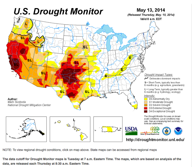
As scary as the map is, it doesn’t convey the true severity of the situation because the impacts are cumulative from several years of drought, particularly in the southwest centered on Northern Texas. Having lived in the Dallas-Fort Worth area from 1980-1993, drought on top of the normal heat can only add to misery. This continuing pattern across so many states will directly affect the price of feed stuffs and food due to poor or no harvests.
For more information, go to US Drought Monitor. Here is a page from that site showing drought information in the contiguous US (CONUS) from 2002-2014: Change Maps. Our area of the Mid Atlantic last saw abnormally dry conditions in 2006 and 2012.


